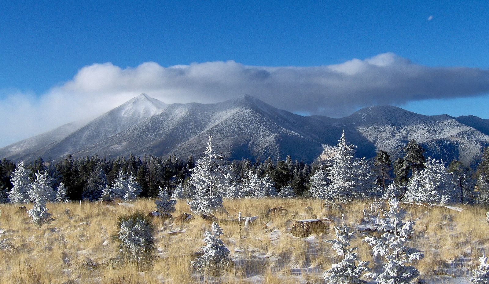
San Francisco Peaks

San Francisco Peaks

Tuesday, March 29, 2016

The resurrection of Pavlof volcano

Welcome to Spring.

Hope you are enjoying snow or sunshine. This post was supposed to be about Mt. Redoubt, but because of the sudden eruption of Pavlof volcano, I decided to discuss Redoubt later.

Pavlof is a strata volcano and pyroclastic cone. It stands 2493 m (8177 ft) high.It last erupted in 2014 when there were thermal anomalies and ash plumes; however, the eruption these last couple of days seems to have had little warning.
Here is Pavlof's location in the Aleutian arc.


March 27, 2016
The seismicity picked up only about a half hour before the eruption. A pilot reported the eruption describing an ash cloud of 20,000 ft.


March 28, 2016
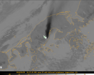
Eruption is continuing. The level of seismic tremor is high. Infrasound sensors have gathered data that the volcano is still erupting ash. The ash cloud is now 37,000 ft.  Lava fountaining could be seen at night by residents 37 miles away (60 km). There is a warning about mud flows as Pavlof is covered in snow and ice.


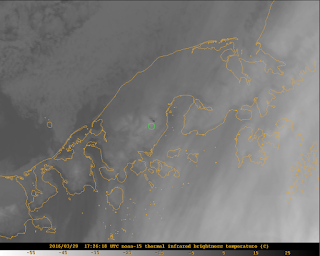
The green circle indicates Pavlof in the satellite images. It might be a little off, but you should be able to see the ash plume and the white and black spots revealing thermal anomalies.


March 29, 2016
 There is no ash plume showing up on satellite data. Yet, the ash cloud could still affect aviation. Seismicity and infrasound levels have dropped, but the seismic tremor is greater than normal background seismicity. The AVO warns that even though the intensity of the eruption has decreased, the volcano is still capable of erupting with little warning (if any at all).

Here is the seismicity for the last 48 hours.
There were 41 flights canceled yesterday and 14 today. The National Weather Service issued an ash fall warning and the village, Nelson Lagoon has almost received an inch of ash accumulation.

This eruption is just a reminder of the unpredictable nature of volcanoes and the many hazards they pose. I did enjoy looking through the satellite images and realizing I could see the ash cloud. I hipe that I can find more data and information on this eruption as it is so recent.

If Pavlof or one of our other fiery friends wakes up more, I will be sure to report on it.
Rachel
Friday, March 11, 2016

Cleveland, Alaska (not the home of the Cleveland Cavaliers)


Case Study

Name: Cleveland
Location: Alaska
Type of Volcano: Stratavolcano
Elevation: 1730 m (5674 ft)
Rock type: Andesite
Hazards: Ash plumes and deposits, steam, gas emissions, lava flows, earthquakes
Monitoring: Seismic stations, infra sound, satellite, webcam, fly-by
Last Eruption: 2015
Current Status: Active
Current Activity: No unusual seismicity, steam and gas plumes seen in satellite images

The case studies are back. 

This is three of four to be completed. Cleveland has been an interesting volcano to research because it is more remote and until recently was monitored by satellite and distant seismic stations. It is also a very majestic volcano with the black volcano clashing elegantly with the green vegetation and blue ocean.


As I noted above, this volcano did not have its own monitoring tools until recently. In August 2014, researchers from the National Science Foundation (NSF) installed two monitoring stations on Cleveland volcano. The two stations measure seismicity and infra sound. Infra sound is the measurement of atmospheric pressure changes at low frequencies that volcanoes put out. Prior to this, Cleveland had been monitored by distant seismic stations, fly-bys, and satellite images. Before you judge the Alaskan Volcano Observatory for not monitoring such an active volcano with more reliable techniques, let me remind you of the size of Alaska. Cleveland volcano is located on Chuginadak Island about 490 km (304 mi) from the western end of the Aleutian Arc-- the volcanic chain that stretches off the coast of Alaska.


Because the volcano is so remote, satellites are relied on heavily to monitor the volcano. Here are some images from http://volcview.wr.usgs.gov/ The red circle is Cleveland volcano.


As I am not a vulcanologist and do not access to higher resolution images, it is hard for me to interpret what I am seeing. But according to the USGS there has been some thermal anomalies and steam and gas plumes within the last week that could be seen from the satellite images.


Here is another image from a fly-by of Cleveland spewing a gas and ash plume.

If Cleveland were to have a large eruption, it would be similar to Mt. St. Helens, if not more explosive. However, the most recent eruptive activity (besides plumes) was a dome-building event in August 2015.
 I think more research into the use of satellite monitoring and its accuracy is in store. It might be an option for the SFVF if it is pretty accurate at detecting activity at Cleveland...

Chao,
Rachel

Saturday, March 5, 2016

Sunset Crater... A millennial

Yeah you're right. This week I visited Sunset Crater. It is the youngest volcano in the San Francisco volcanic field.

Here's a picture of the volcano.

Sunset Crater is a cinder cone just like SP crater. It erupted about a thousand years ago. 
The eruption is characterized as three events. First, a fissure about 6.2 miles long opened up in the ground and began spewing lava and rock. Eventually, the eruption became centered at one end of the fissure. It began to build up the volcano we now know as Sunset Crater. The final event was the lava flow that emerged from the western base of the volcano.
 This flow is named the Bonito lava flow. It is basaltic lava that became rough and jagged as it cooled. There are also cracks in the flow formed by the frictional drag on the upper portion of the lava flow by the fluid lava below. The flow also has "hornitos" or small cones of spattered rock that sprays of lava built up.
Here are some pictures of the Bonito lava flow:


 This photo displays the size of the holes created by escaping gases as the rocks cooled.
This is an example of the cracks that opened within the lava flow.

In the Sunset Crater visitor center, there was a sign describing the seismic station behind the Wupatki visitor center. The nickname of the station is WUAZ. It is not monitoring volcanic activity because there is no real concern about the renewed activity. It is part of the dozen or so stations across the state of Arizona that just monitor for earthquakes. The visitor center had realtime data from the seismometer.

Another interesting piece of data was this map.
You'll notice the seismic activity around Sunset Crater. In some ways it is concerning that we don't exactly know if there is volcanic activity occurring.

But that's what this project will attempt to address.

Bye.
Rachel