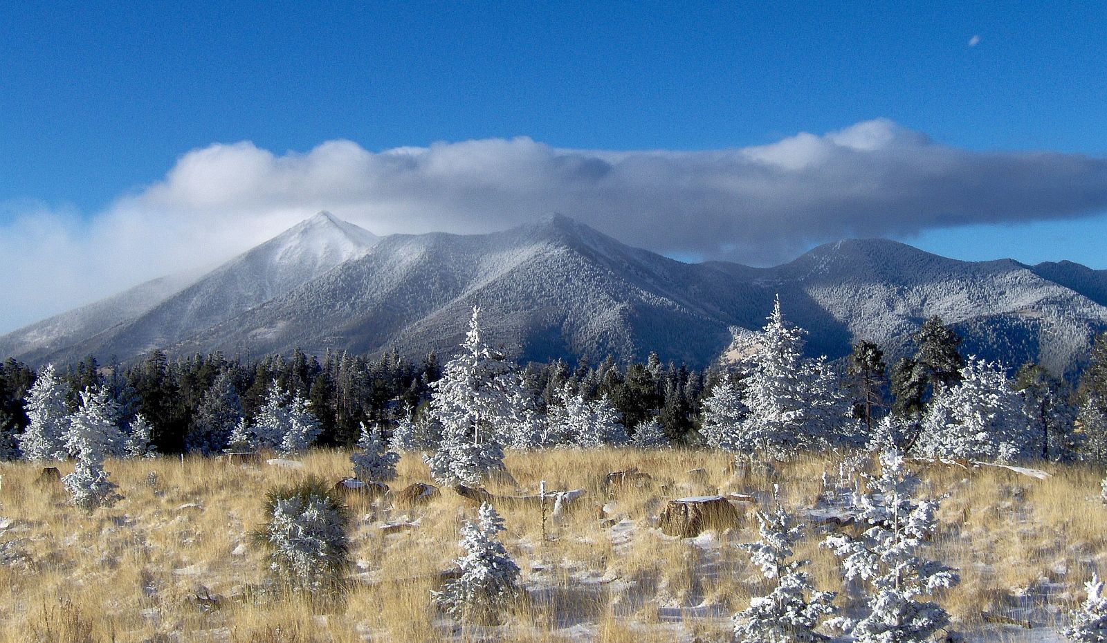
San Francisco Peaks

San Francisco Peaks

Tuesday, March 29, 2016

The resurrection of Pavlof volcano

Welcome to Spring.

Hope you are enjoying snow or sunshine. This post was supposed to be about Mt. Redoubt, but because of the sudden eruption of Pavlof volcano, I decided to discuss Redoubt later.

Pavlof is a strata volcano and pyroclastic cone. It stands 2493 m (8177 ft) high.It last erupted in 2014 when there were thermal anomalies and ash plumes; however, the eruption these last couple of days seems to have had little warning.
Here is Pavlof's location in the Aleutian arc.


March 27, 2016
The seismicity picked up only about a half hour before the eruption. A pilot reported the eruption describing an ash cloud of 20,000 ft.


March 28, 2016
Eruption is continuing. The level of seismic tremor is high. Infrasound sensors have gathered data that the volcano is still erupting ash. The ash cloud is now 37,000 ft.  Lava fountaining could be seen at night by residents 37 miles away (60 km). There is a warning about mud flows as Pavlof is covered in snow and ice.


The green circle indicates Pavlof in the satellite images. It might be a little off, but you should be able to see the ash plume and the white and black spots revealing thermal anomalies.


March 29, 2016
 There is no ash plume showing up on satellite data. Yet, the ash cloud could still affect aviation. Seismicity and infrasound levels have dropped, but the seismic tremor is greater than normal background seismicity. The AVO warns that even though the intensity of the eruption has decreased, the volcano is still capable of erupting with little warning (if any at all).

Here is the seismicity for the last 48 hours.
There were 41 flights canceled yesterday and 14 today. The National Weather Service issued an ash fall warning and the village, Nelson Lagoon has almost received an inch of ash accumulation.

This eruption is just a reminder of the unpredictable nature of volcanoes and the many hazards they pose. I did enjoy looking through the satellite images and realizing I could see the ash cloud. I hipe that I can find more data and information on this eruption as it is so recent.

If Pavlof or one of our other fiery friends wakes up more, I will be sure to report on it.
Rachel

Friday, March 11, 2016

Cleveland, Alaska (not the home of the Cleveland Cavaliers)


Case Study

Name: Cleveland
Location: Alaska
Type of Volcano: Stratavolcano
Elevation: 1730 m (5674 ft)
Rock type: Andesite
Hazards: Ash plumes and deposits, steam, gas emissions, lava flows, earthquakes
Monitoring: Seismic stations, infra sound, satellite, webcam, fly-by
Last Eruption: 2015
Current Status: Active
Current Activity: No unusual seismicity, steam and gas plumes seen in satellite images

The case studies are back. 

This is three of four to be completed. Cleveland has been an interesting volcano to research because it is more remote and until recently was monitored by satellite and distant seismic stations. It is also a very majestic volcano with the black volcano clashing elegantly with the green vegetation and blue ocean.


As I noted above, this volcano did not have its own monitoring tools until recently. In August 2014, researchers from the National Science Foundation (NSF) installed two monitoring stations on Cleveland volcano. The two stations measure seismicity and infra sound. Infra sound is the measurement of atmospheric pressure changes at low frequencies that volcanoes put out. Prior to this, Cleveland had been monitored by distant seismic stations, fly-bys, and satellite images. Before you judge the Alaskan Volcano Observatory for not monitoring such an active volcano with more reliable techniques, let me remind you of the size of Alaska. Cleveland volcano is located on Chuginadak Island about 490 km (304 mi) from the western end of the Aleutian Arc-- the volcanic chain that stretches off the coast of Alaska.


Because the volcano is so remote, satellites are relied on heavily to monitor the volcano. Here are some images from http://volcview.wr.usgs.gov/ The red circle is Cleveland volcano.


As I am not a vulcanologist and do not access to higher resolution images, it is hard for me to interpret what I am seeing. But according to the USGS there has been some thermal anomalies and steam and gas plumes within the last week that could be seen from the satellite images.


Here is another image from a fly-by of Cleveland spewing a gas and ash plume.

If Cleveland were to have a large eruption, it would be similar to Mt. St. Helens, if not more explosive. However, the most recent eruptive activity (besides plumes) was a dome-building event in August 2015.
 I think more research into the use of satellite monitoring and its accuracy is in store. It might be an option for the SFVF if it is pretty accurate at detecting activity at Cleveland...

Chao,
Rachel

Saturday, March 5, 2016

Sunset Crater... A millennial

Yeah you're right. This week I visited Sunset Crater. It is the youngest volcano in the San Francisco volcanic field.

Here's a picture of the volcano.

Sunset Crater is a cinder cone just like SP crater. It erupted about a thousand years ago. 
The eruption is characterized as three events. First, a fissure about 6.2 miles long opened up in the ground and began spewing lava and rock. Eventually, the eruption became centered at one end of the fissure. It began to build up the volcano we now know as Sunset Crater. The final event was the lava flow that emerged from the western base of the volcano.
 This flow is named the Bonito lava flow. It is basaltic lava that became rough and jagged as it cooled. There are also cracks in the flow formed by the frictional drag on the upper portion of the lava flow by the fluid lava below. The flow also has "hornitos" or small cones of spattered rock that sprays of lava built up.
Here are some pictures of the Bonito lava flow:


 This photo displays the size of the holes created by escaping gases as the rocks cooled.
This is an example of the cracks that opened within the lava flow.

In the Sunset Crater visitor center, there was a sign describing the seismic station behind the Wupatki visitor center. The nickname of the station is WUAZ. It is not monitoring volcanic activity because there is no real concern about the renewed activity. It is part of the dozen or so stations across the state of Arizona that just monitor for earthquakes. The visitor center had realtime data from the seismometer.

Another interesting piece of data was this map.
You'll notice the seismic activity around Sunset Crater. In some ways it is concerning that we don't exactly know if there is volcanic activity occurring.

But that's what this project will attempt to address.

Bye.
Rachel

Monday, February 29, 2016

SFVF- SP Crater and friends

Hi,

This last week I went out with a local geologist on a field trip to visit SP Crater and its friends. Ken Walters was my guide on our adventure. I picked up some cool rocks that are good examples of tephra.

We drove north on Highway 89 past Wupatki, then turned left on a unmarked dirt road. We passed many Babbitt cows on our way to SP's neighboring cinder cone pictured below.

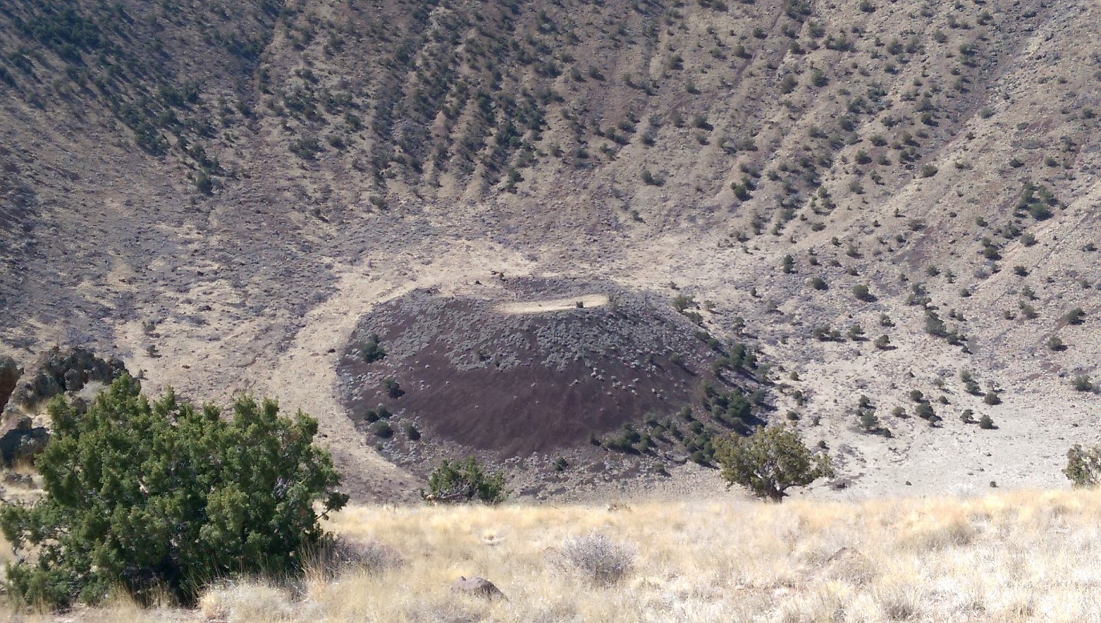
 This cinder cone* is older than SP because of all the vegetation covering its slopes. It is interesting to note the small cinder dome in the center of the volcano showing that even after the cone stopped spewing lava into the air, there was still activity. It also seems the the side of the cinder cone was blown out at some point as that side of the volcano is lower than the rest.

Looking at a map of the SFVF helps to visualize the location of these volcanoes. If you can see on the map, there is a fault labeled "Doney Park Fault." This fault can be easily seen from both SP Crater and the cinder cone discussed above.

Our nest adventure was up the side of SP Crater or **** Pot Crater because it looks a lot like a toliet.
Formidable right? Although only 800 feet high, it was a steep hike with loose cinders so you were constantly trying to not slid backwards. The volcano is about 71,000 years old. Below you can see some good examples of flow patterns. Apparently quarters are the standard tool for gauging size, but since I didn't have any I utilized a normal chapstick. Notice the curves and seeming rough texture. This was caused by the lava being squeezed out of the ground, much like the shape of frosting coming out of differing tubes. Also shown is the middle of the volcano. Like its neighbor, SP mostly erupted lava and rocks that fell back down around it, thus creating the cinder cone we see today.


SP mostly spewed out basalt, but towards the end of its life the magma burst through the bottom, creating a black lava flow across the ground. The lava flow was quite sharp and treacherous, but ion some places one could see how the lava fit together before it got weathered and broken apart.


Scientists are still unsure where the magma came from to cause the formation of these volcanoes, but there are two theories: 1) like Yellowstone, the SFVF is sliding over a "hot spot" in the mantle that has caused string of volcanoes seen starting out near Williams and stretching beyond Flagstaff onto the Navajo Reservation, or 2) a chunk of the lithosphere is sliding under a denser part of lithosphere and the rock is melting because it is coming into contact with warmer temperatures and higher pressure. Whatever the source is, we do not know where it is from or when it will reveal itself next...

Rachel signed out.

*The name of that cinder cone is Colton Crater.

Friday, February 19, 2016

Kilauea, Hawaii (No it is not about a dream vacation)


Case Study

Name: Kilauea
Location: Hawaii
Type of Volcano: Shield, Caldera, Pyroclastic cone
Elevation: 1247 m (4091 ft)
Rock type: Basalt
Hazards: Lava Deltas, Vog, Lava Flows, Gases (SO2), Earthquakes, Tsunamis, Tephra jets, Steam Blasts, Acidic Fumes, Glass Particles, Scalding Waves, Ash Clouds and Plumes
Monitoring: Seismographs, Tiltmeters, EDM, GPS, Satellite, Thermal and Regular Cameras, Gas Emissions
Last Eruption: Whenever you are reading this. Last explosive eruption occurred in 2011
Current Status: Active
Current Activity: Eruptions in summit and East Rift Zone, ground deflation, lava lake lowered from 33 m to 46 m below the rim of Overlook Crater, low seismic activity (as of 8:56 am February 19, 2016) 

Afternoon,

Today we will discuss Kilauea. It is probably the most famous volcano of Hawaii with two million annuals visitors to the Hawaii Volcanoes National Park. If you have ever seen pictures of lava flows or lava fountains in Hawaii, then you have already seen Kilauea. It is the youngest volcano in the world and the most active as almost everyday there is eruptions occurring in the summit or East Rift Zone. With its ongoing eruptions, Kilauea has buried 45 square miles of volcano and added 560 acres of new land to the island.

The volcano has a large explosive eruption about as often as volcanoes like Mt. St. Helens, but has continuous smaller eruptions taking place.Many times these eruptions are hazardous to the people living on the island of Hawaii. For example, in 1986 a lava flow cut through the town of Kapa’ahu destroying homes and caused a highway to close. In 2011, another flow from the Pu'u 'O'o crater destroyed homes. Most recently, in the autumn of 2014, a lava flow threatened the community of Pahoa. It again destroyed some homes, but also crossed streets, moved along the cemetery driveway before turning into a pasture.


However, the most important takeaways from Kilauea have to do with predicting eruptions. Before a summit eruption, the caldera's floor usually drops and seismicity and gas output increase. McGuire (1995) found that seismic and ground deformation measurements have been the best ways to forecast eruptions at Kilauea. Ground inflation within the summit region that is accompanied by distinct, short period seismic events generally signals a replenishment of the magma reservoir. Later events include a sudden deflation of ground followed by an increase in the frequency of longer seismic events that illustrate an intrusion of magma into a rift. Because Kilauea has been monitored for over 100 years, there is an abundance of data on the volcano. This data allows scientists to more easily predict eruptions.

Because Kilauea is a continuous eruption, different techniques can be tested and developed by monitoring it remotely because it is also being monitored closely from the ground. Data is be shared from the satellites and the ground instruments to understand how to calibrate satellites correctly so that they can be interpreted accurately.


Again though, volcanoes are still mysteries. Even Kilauea with all the scientists and instruments watching it is able to erupt with no warning. 

But it does have a cool feature. There are live webcams on the Hawaiian Volcano Observatory website: http://hvo.wr.usgs.gov/cams/

Here is a picture of the lava lake from today.


Until later,
Rachel
 

Thursday, February 11, 2016

Mauna Loa, Hawaii... Not exactly Mustafar


Case Study

Name: Mauna Loa
Location: Hawaii
Type of Volcano: Shield, Caldera
Size: 4,169 m (13,679 ft)
Rock type: Basalt
Hazards: Lava Flows, Gas Emissions, Lava Fountains, Earthquakes, Ground Movement, Vog (Volcanic Smog)
Monitoring: Seismographs, Tiltmeters, GPS
Last Eruption: March 25-April 15, 1984
Current Status: Active
Current Activity: No eruptions, but some seismic activity and ground movement.

Hi,

This week I have been researching the volcano Mauna Loa ("Long Mountain") located on Hawaii Island. Mauna Loa is the largest volcano in the world. It covers more than half the island. It is concerning that this island also has the fastest growing population in Hawaii. Residents are encouraged to learn about the hazards the volcano poses so that they are prepared for eruptions. Unlike Flagstaff, this shield volcano gives evidence of its active status. There are rifts on the volcano, which release gases and sometimes lava.

Mauna Loa is part of the Hawaiian island chain. This volcanic chain was created by a hot spot (a place in the earth's subsurface where magma has risen into mantle) that the Pacific Plate is passing over. While Kilauea is one of the most active volcanoes, Mauna Loa is classified as active and is predicted to have a large eruption within our lifetimes.

The most famous eruption of Mauna Loa occurred in 1984. Scientists started recording an increase in shallow and intermediate earthquakes in 1983 accompanied with an extension of the surface of the volcano. Based on previous eruptions and indicators, they assumed that magma had intruded into the magma chamber, which made the possibility of an eruption more certain.

A satellite detected the volcano's eruption after discovering an unusual infrared signal from the volcano. The eruption consisted of a lava fountain (seen below), venting at the rifts, the creation of new rifts, and lava flows. The flow was especially dangerous as it advanced towards the town of Hilo, destroying levees meant to check its flow. Luckily the eruption slowed and the lava became stickier, so the town was not damaged; however, it was a reminder of the dangers of living close to an active volcano. Yet, the vog caused by the eruption hung over Hawaii for a while.

Due to the satellite and to the constant monitoring of the volcano, scientists and residents were more prepared for the eruption to occur. In Flagstaff, we aren't as concerned about the hazards our beautiful Peaks and the SFVF pose. This case study illustrates the benefits of monitoring and the unpredictability of volcanoes. Despite the baseline data that scientists had on Mauna Loa, they still could not predict when the volcano would erupt. They could only claim that they thought it would be based on previous behaviour.

Next week we will take a look at another Hawaiian volcano, Kilauea.

An interesting volcanic event this week: Japan's Sakurajima erupted on Sunday (February 7, 2016). The fountain of lava was not just shooting out glowing orange material, but lightning too. It is strangely pretty. To watch a video see http://www.huffingtonpost.com/entry/sakurajima-volcano-lightning_us_56b8016ce4b08069c7a7c782

Chao,
Rachel

Friday, February 5, 2016

Volcano Monitoring Basics-- how we try to unravel explosive mysteries

Welcome back. I do hope that you haven't had any unfortunate run ins with active volcanoes yet. 

As I have buried myself in reviewing relevant literature, I've found the main techniques volcanologists use to monitor active and dormant volcanoes. I am going to share these with you, but you are more than welcome to space out for the next five paragraphs.

Volcanologists use a variety of instruments to monitor volcanoes that are either ground based or space based (satellites).

Most ground based instruments measure ground deformation and seismic activity. Ground deformation is normally measured by two different instruments: a tiltmeter or a Electronic Distance Measurement (EDM). A tiltmeter is a device similar to a carpenter's level that uses a small container filled with a conducting fluid and a bubble to measure the change in slope of the ground. EDMs measure the extension and contraction of the ground using benchmarks that are placed on a volcano to send and receive electromagnetic signals. Both techniques measure the movement of magma under the Earth’s surface.

Seismic waves are measured with, yes, seismometers.From the recorded seismic waves, volcanologists are able to determine the structure and plumbing system of the volcano.

The introduction of satellites into the scientific research is beneficial to the monitoring of volcanoes because it has allowed volcanologists to remotely study volcanoes. Much like ground based techniques, synthetic aperture radar interferometry (InSAR) measures the displacement of a volcano’s surface in terms of magma movement beneath the ground. Satellites also provide photographs of the Earth, which allows scientists to spot ash plumes and changes to the topography of volcanoes. They use radar too as it provides images of the Earth even when it is dark or there is heavy cloud cover.

By analyzing data, volcanologists can attempt to predict eruptions, but they must have a proper amount of baseline data on volcano. When volcanologists have this background knowledge, they are able to discern between the normal workings of a volcano and eruptive behaviour.

However, volcanoes remain mysterious and mischievous because they often give no warning signs that they are about to erupt, or they display eruptive signs and never erupt. This is why it is crucial to make the public aware of the hazards volcanoes pose, even if they are dormant for the time being.

 I also receive updates on active volcanoes. Today, Kilauea (Hawaii), Shishaldin, and Cleveland (Alaska) are all displaying signs of activity. If you would like to receive these daily updatessign up at: https://volcanoes.usgs.gov/vns/register.php

Have a gneiss day,
Rachel